Maps that I have created (for fun)
I create a lot of maps, just for fun.
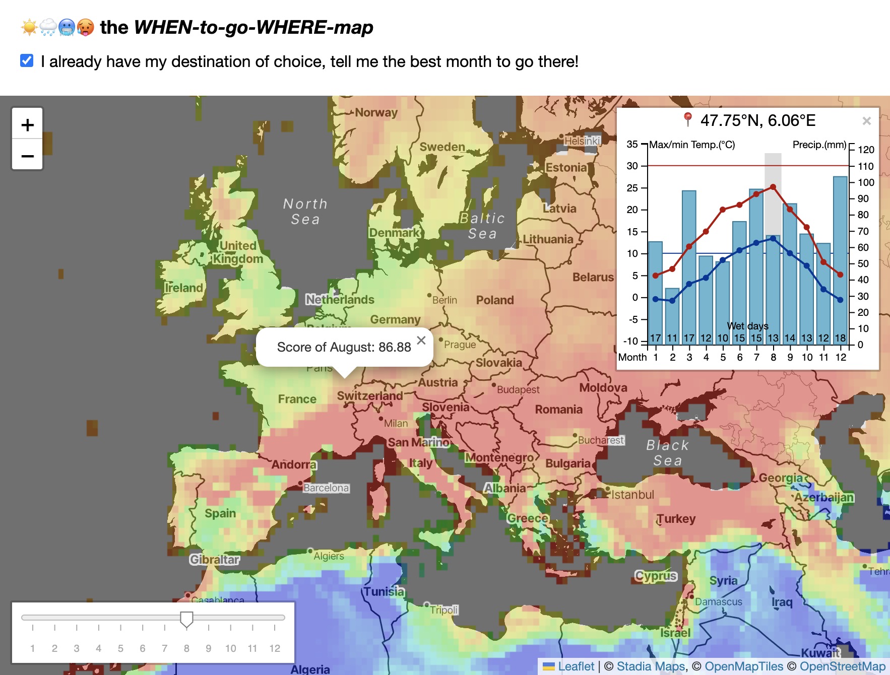
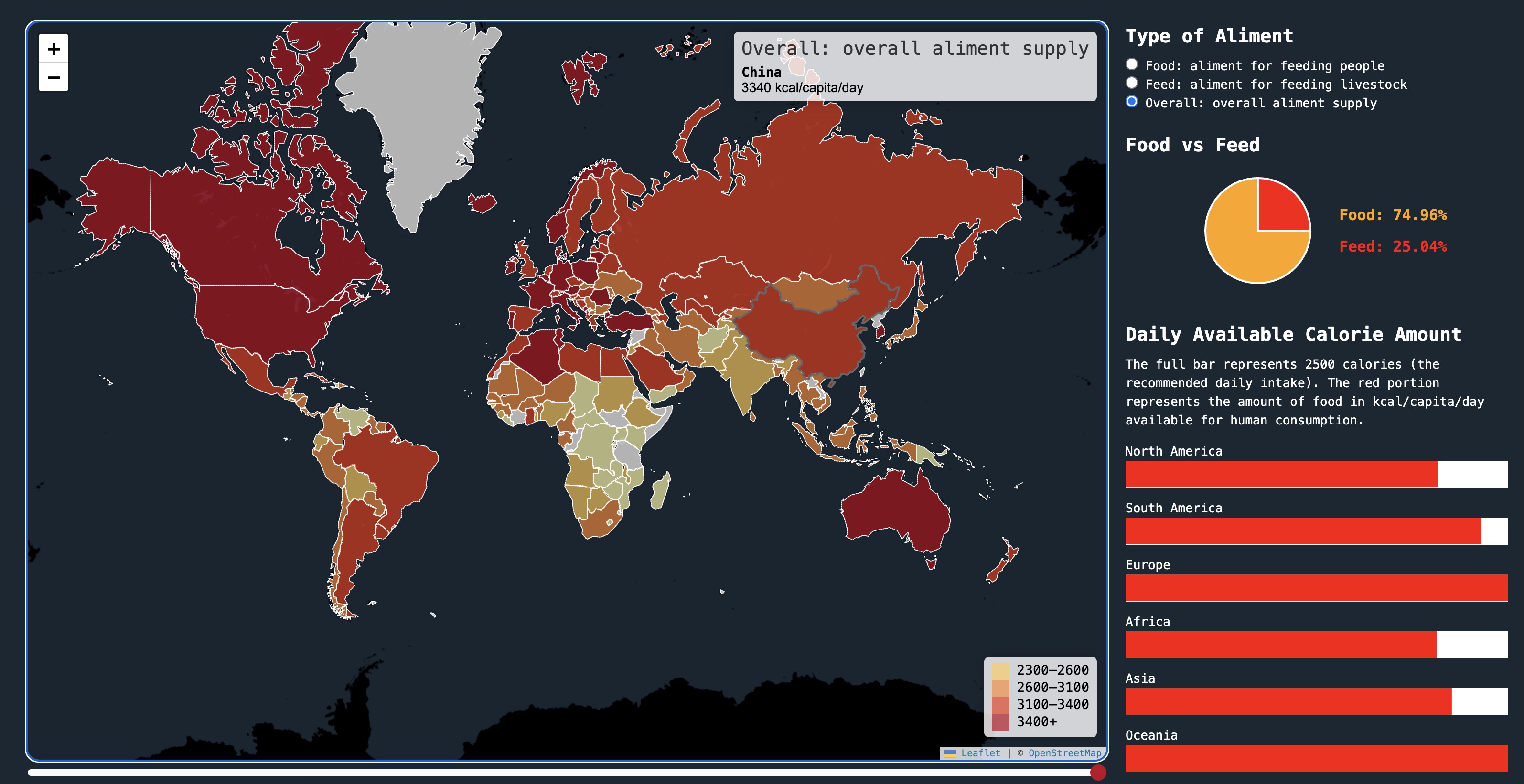
The Interactive WHEN-to-go-WHERE Map
The interactive WHEN-to-go-WHERE Map leverages the CTU TS monthly climate data to help you find the most comfortable place to travel for a given month, or find the most comfortable month to travel for a given place.
Restricted to personal use at the moment, with a plan to expand into a business.
Stack: Python, leaflet.js, D3.js, OpenLayers (in progess), PostGIS (in progess)
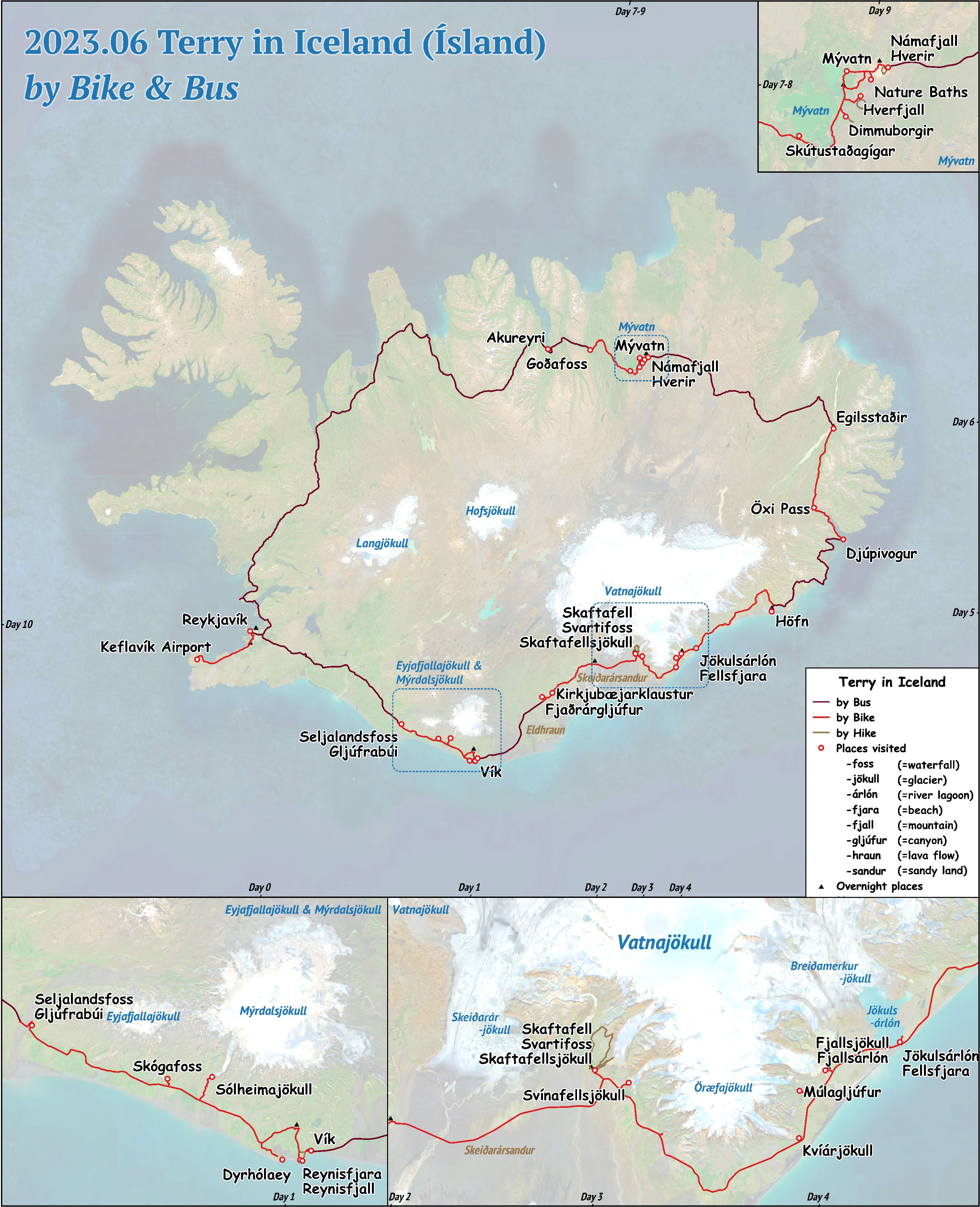
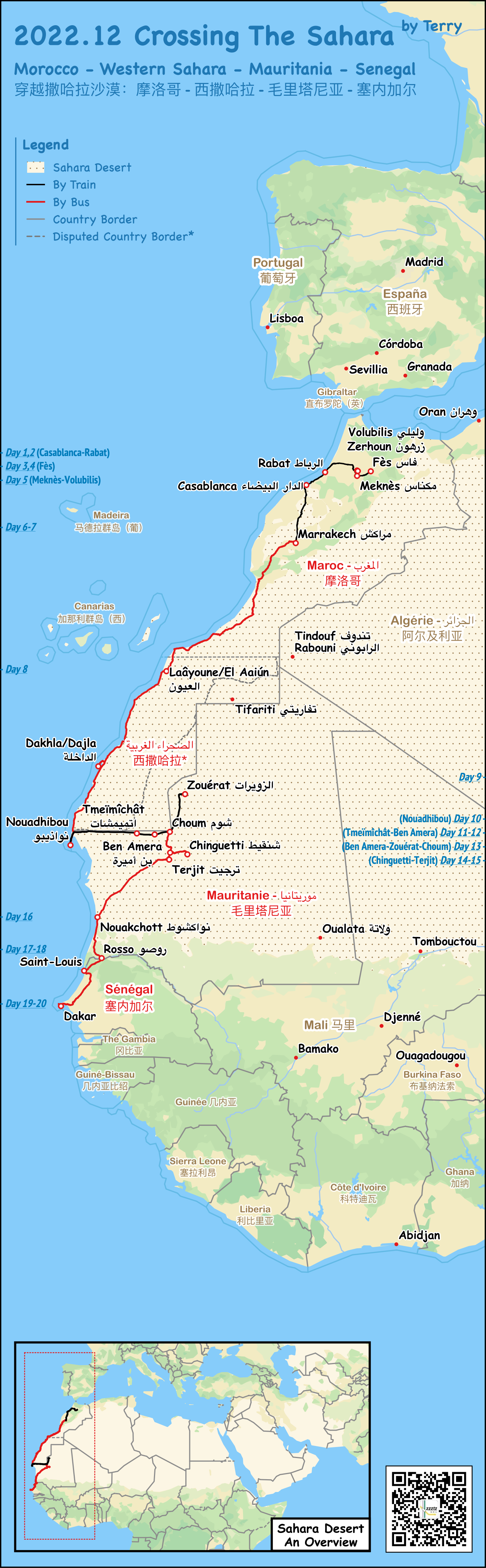
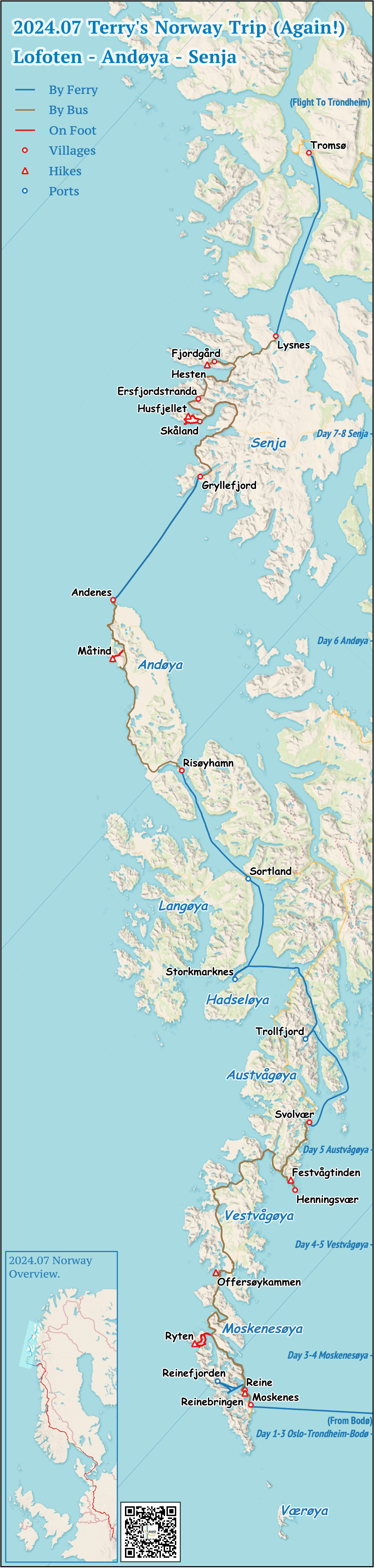
Plenty of Static Maps
I create static maps for every trips that I have done. See my personal blog (in Chinese) for more maps.
Examples here include maps of me…
- Bikepacking in Iceland
- Crossing the Sahara by public transport
- Traveling to northernmost point of Europe by public transport
Stack: QGIS, Overpass API
Maps for course project
Map visualizes ! I love to add maps to course projects to help explain things. Example here.
Stack: D3.js
Misc
I am an avid advocate for the open-source map OpenStreetMap which I contribute from time to time. (In case you do not know, Strava, Alltrails, FATMAP - they all use OpenStreetMap data.) I also develop useful GIS tools as a part of the OpenStreetMap China Team.